
Find thick young softwood before you leave the truck.
For hunters, trackers and wildlife photographers. Hare Finder reads how long ago the woods near any New Hampshire address were cut, how much spruce and fir is growing back, and where the swamp edges are, then shows where the cover suits snowshoe hare. Each spot is explained in plain English: whose public land it's on, the way in over public ground where it can be checked, and how far it is from the nearest house. It maps terrain, not property rights or legal access.
Reads cover and habitat only, not whether game is there today. Hare Finder checks maps against set criteria and shows where the cover suits snowshoe hare. A spot is not permission to hunt, enter or cross any land, and never means hunting is legal there.
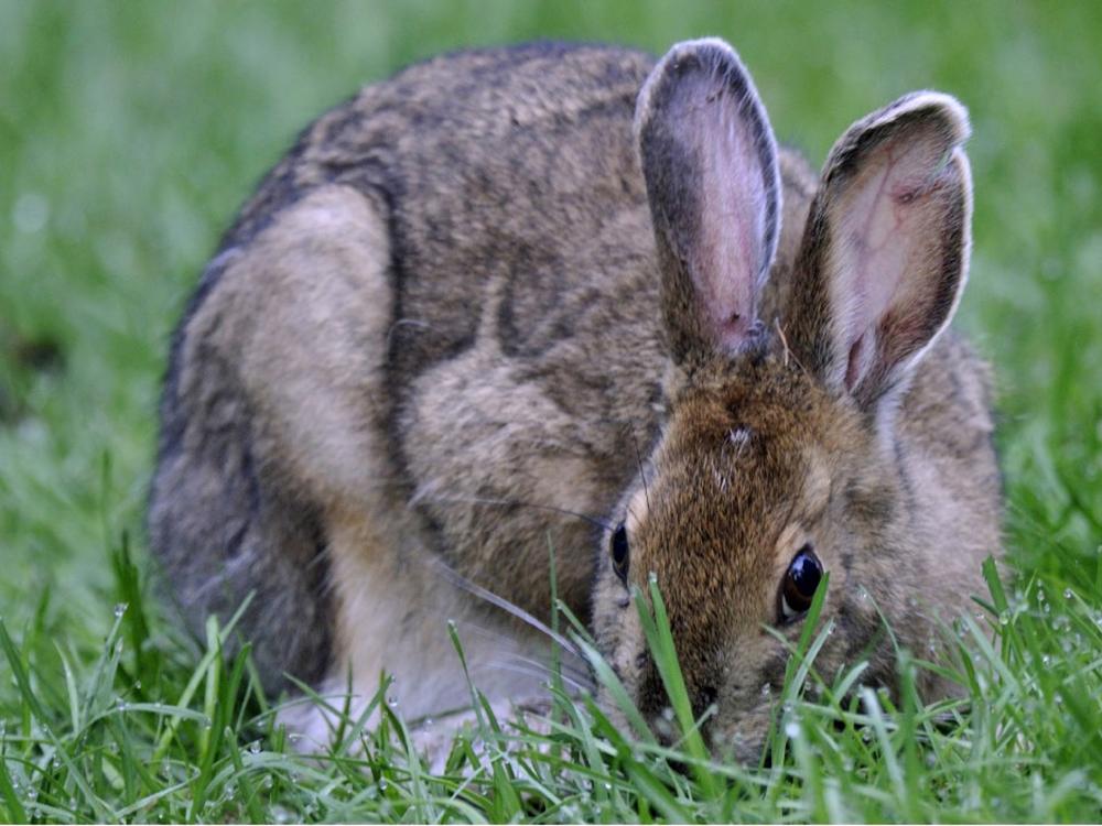
Snowshoe hare, New Hampshire
Beta testers
Sign in, or create a free account. Beta testers with an invite code get everything free this winter.
Most of the woods aren't hare woods
Snowshoe hare live in thick cover: dense young spruce and fir, softwood swamps and their edges, and understory so tight you push through it. Most woods have grown past that stage, and from the road it all looks the same.
Cuts thicken, then thin out
A spruce-fir cut is open for a few years, thick for a couple of decades, then the stems thin out as the trees grow. Knowing when each patch was last cut is most of the job.
Softwood, and lots of it
Hares lean on softwood cover in winter, and on big blocks of woods rather than small, isolated patches. Swamp edges add more.
Whose land, and how far from houses
National forest, state forests, wildlife management areas and town land each have their own rules, and some allow walking or watching where they don't allow hunting. New Hampshire law bars shooting within 300 feet of an occupied house without permission (RSA 207:3-a).
Getting in is half the battle
Some cover is a short walk from a road. Some is behind a gate or a long way from anything, and you'd rather learn which at home.
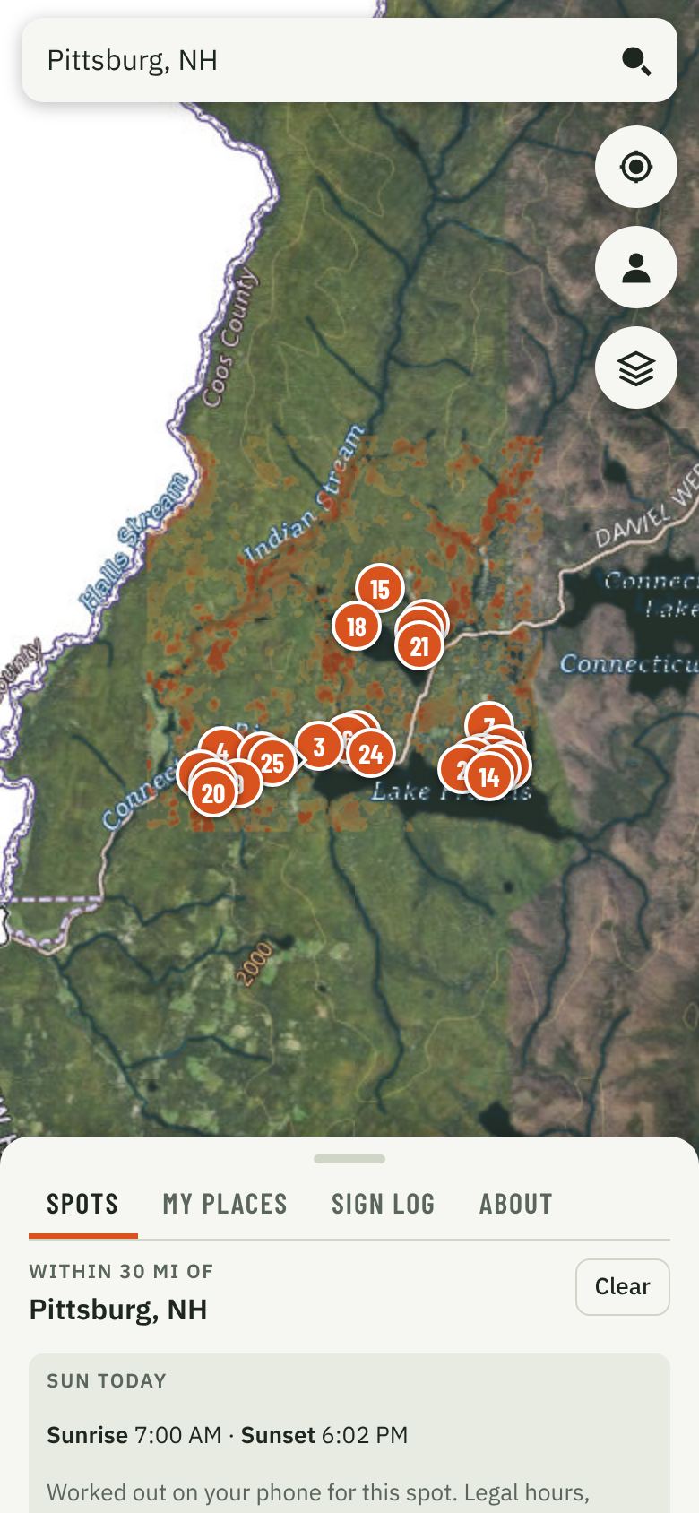
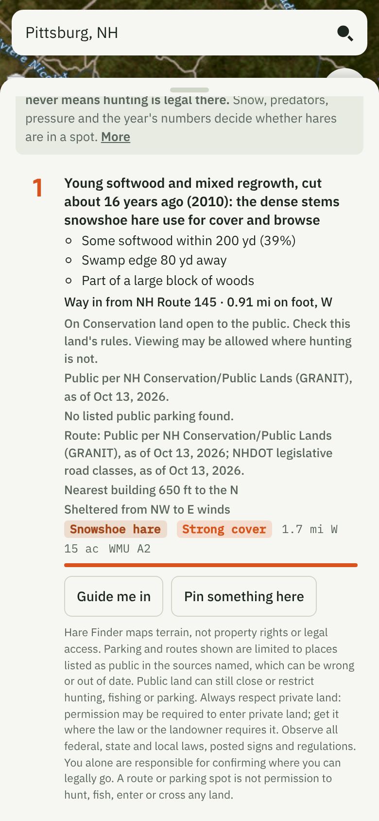
Real screens from the beta build, near Pittsburg, NH. Shown with every spot on (Pro).
What Hare Finder shows you
Search an address or tap your location. You get the highest-ranked hare cover around it (2.5 miles on Free, 5 on Starter, 30 on Pro), each spot explained in plain English.
-
Why each spot ranks
How long ago it was cut, how much spruce and fir is in it and around it, how close the swamp edge is, and how big the block of woods is.
-
How to get in
Where a cover can be reached from a listed public lot over land open to the public, you get the lot, the walk-in on public ground and driving directions, on every plan. Routes stay on listed public land, state and town roads and Forest Service roads and trails. If any part can't be checked, there's no route, and the spot says so. Never a route or parking to private land. Pro adds Guide me in, a GPS arrow from the truck to the spot.
-
Whose land, and how close the houses are
The public land each spot sits on, such as the White Mountain National Forest, a state forest or a wildlife management area, with a reminder to check its rules, plus the distance and direction to the nearest building.
-
Which winds it's sheltered from
Based on the tall cover around each spot, so you can match the spot to the forecast.
-
A sign log that works with no signal
Pin hare tracks, sightings, browse, droppings, photos you took, or "looked here, no hare sign." Pins stay private on your phone unless you choose to share them.
Get the app
Hare Finder installs straight from this page to your home screen. No app store needed. It works with no signal in areas you've already opened.
- Opens full screen from its own icon, like any other app.
- Updates itself. Nothing to download again.
Need to reinstall? Remove the icon from your home screen, then open this site in Chrome (Android) or Safari (iPhone) and follow the steps below. Turn on backup first if you want your places and trails to come back.
On Android, install from Chrome. This browser builds its own version of the app, and Google Play Protect can block it as "built for an older version of Android".
Open in ChromePlaces and trails you've saved in this browser stay in this browser unless backup is on.
iPhone or iPad
- Open this site in Safari.
- Tap the Share button at the bottom (top right on iPad).
- Scroll down and tap Add to Home Screen, then Add.
Android
- Open this site in Chrome.
- Tap the menu ⋮ at the top right.
- Tap Add to Home screen (or Install app), then Install.
What it can't tell you
Reads cover and habitat only, not whether game is there today. Hare numbers rise and fall over the years, and snow, predators and hunting pressure decide where they are on a given day. Nothing replaces walking the cover. It has weak spots you should know about:
- The 2021 national land cover misses cuts made since then, and satellite cut dates miss light partial cuts and stands cut before 1985.
- It can't see how thick the understory is under older trees.
- It's still being checked in the field this winter by beta testers.
Use it to choose where to look, then trust your eyes. Whether you carry a shotgun or a camera, confirm who owns a spot and what its rules allow.
The rules are on you. You're solely responsible for knowing and following every law, season, bag limit, protected-species rule, safety zone and land-access rule wherever you go, and for identifying any animal before you take it. In New Hampshire you may not discharge a firearm within 300 feet of a permanently occupied dwelling without permission of the owner or occupant (RSA 207:3-a); confirm with NH Fish and Game. Building distances in the app are estimates from public data and can miss houses. Seasons and limits change every year: check the NH Hunting Digest and NH Fish and Game (links last checked October 12, 2026). Hunting hare with dogs has its own rules.
A spot is not permission to hunt, enter or cross any land, and never means hunting is legal there.
How we check it
Beta testers log hare tracks, sightings, browse and droppings this winter, and the places they looked and found none. Snow makes hare sign easy to read. We compare Hare Finder's ranking against a simple one that ranks woods by land-cover class alone. If Hare Finder doesn't beat that, we won't charge for it.
Results are pending. We'll post them here when the winter's checks are done.
Know what you're looking at
Why the map is empty in the south
New England cottontail is state-endangered in New Hampshire and closed to all hunting, and in the field it is nearly impossible to tell from eastern cottontail. Hare Finder shows no spots and no heat in the Wildlife Management Units where cottontail hunting is open (H2, K, L and M), and it never shows rabbits.
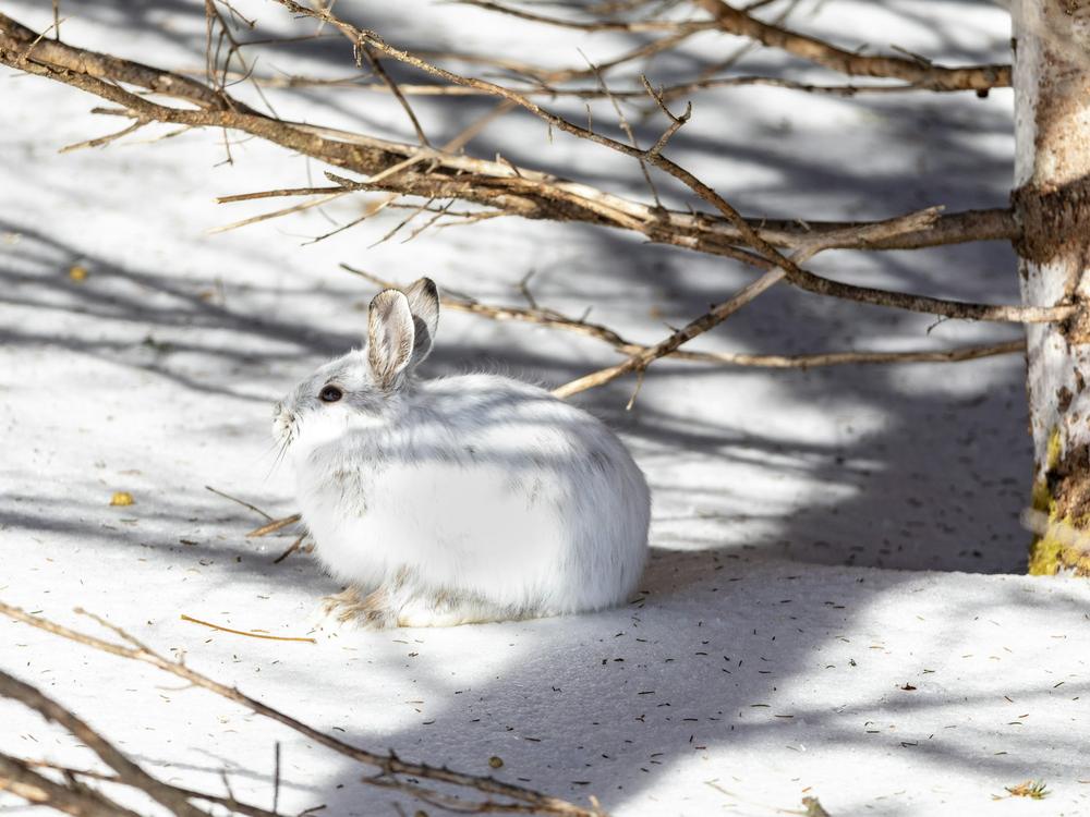
Snowshoe hare are larger, with big furred hind feet and long ears, brown in summer and white in winter. Be certain of what you're looking at before you shoot; if in doubt, don't.
Free this winter, by invitation
We're opening Hare Finder to a small group of New Hampshire hare hunters, trackers and photographers this winter. Use it, log the hare sign you find and the places you find none, and tell us where it's right and where it's wrong.
Not ready to ask? Make a free account: movement tracking, waypoints and 5 spot searches, each showing the top 3 spots on listed public land within 2.5 miles, with the public lot, walk-in and driving directions where they can be checked.
The Finder apps
Hare Finder is one of the Finder apps from Northwoods Investment LLC, each reading the land or water for a different kind of wildlife, for hunters, anglers, watchers and photographers alike. Each says what it reads, never that animals will be there.